Tomo Posted November 3, 2006 Report Posted November 3, 2006 Hi Guys, Just become a member and have got my boat moored at Tuckton...could anyone tell me the approximate depth at low water springs tides at the end of the run? Have heard so many diffrent opinions! My boat draws 2 ft but have been told not a lot of chance of getting in at the bottom of the tide. Quote
Wedger Posted November 3, 2006 Report Posted November 3, 2006 There are greater experts on this than I but a general rule would be not to try it 1.5 hours either side of low water. Paul J would be the one to ask. I once grounded my wilson F 17 with the engine trimmed out going through there, so at 2 feet draft a little caution is advised. The bar is littered with bits of prop and skeg Good luck Quote
Paul J Posted November 3, 2006 Report Posted November 3, 2006 Trev, is spot on if in dought let someone else go first! An auxilarily engine and a pair of waders are useful if your going to risk it ouside of those time frames. Prop reveloutions will only be too pleased if you don't follow these guidelines PJ Quote
Paul D Posted November 3, 2006 Report Posted November 3, 2006 100% guaranteed that you wont get through the run on a low water spring tide. I can get my Orkney through there on around 0.9 metres on the tide table. The smaller LW of the two on a neap I can get through but springs - not a cat in hells chance. If the depth doesnt get you then the current ripping through and the inability to steer with a high degree of tilt on your engine will ! I can show you my selection of destroyed props if you don't believe me Quote
Newboy Posted November 3, 2006 Report Posted November 3, 2006 Following other boat is not 100% proof either. I was on Simon's boat and came in following a large 2x125hp open deck cruiser (could have been a large Boston Whaler), we were thinking if he can get thru we can get thru. Just say we were wrong. Quote
Tomo Posted November 3, 2006 Author Report Posted November 3, 2006 Thanks for that Lads......don't intend to find out the hard way! 2 hrs...it is then...better safe than OUCH Quote
alun j. Posted November 3, 2006 Report Posted November 3, 2006 and.....to complicate matters.........it's always changing shape!!, varies from summer to winter and the effects of atmospheric pressure on sea levels. Go and have a look on Sunday or Monday afternoon, about 3 or 4; an average sort of Spring low but High pressure will push the water down another 20 - 30 cms and the gravel will be visible over huge area and you will think 'Channel??? What channel??' Alun. Quote
britboard Posted November 3, 2006 Report Posted November 3, 2006 The bar is littered with bits of prop and skeg Yep!, if anyone goes down at low water can i have my bits back please Simon L Quote
Pugwash Posted November 4, 2006 Report Posted November 4, 2006 If you are drawing 2 feet it might even be an idea not to risk it more than 1.5 hours either side of HIGH water. As others have said a combination of current and swell can drop the old prop nicely on the bottom. Chart datum is I think around 0.5 metres. If we call that 18 inches in old money you can see what I mean. It worried me at first, you could almost cut the tension with a knife on my boat. You soon get used to it though and we all ding props at some time or other. Or in my case nearly all the time! It's probably better to be over cautious at first until you get the feel of things. Steve Quote
Gazza Posted November 4, 2006 Report Posted November 4, 2006 Have you guys ever thought of using a prop guard ? The type that looks like a steel cage. I know they are expensive but would it be better in the long run. got a picture of one somewhere but not to sure how to put it on! Gary Quote
Bob F Posted November 4, 2006 Report Posted November 4, 2006 A picture won't offer much protection, Gazza, you'll need the real thing. ...where's that blimin coat?? Quote
alun j. Posted November 5, 2006 Report Posted November 5, 2006 Just been down there to see it at Spring Low......... .........and most of the buoys have gone, leaving two yellow and a distant red one. So beware......... keep inshore of the two yellow buoys , they are on the edge of the two largest gravel banks. Alun. Quote
Paul J Posted November 5, 2006 Report Posted November 5, 2006 (edited) All the buoys were there in the morning and we needed them in the mist!. Gone by the time we got in. most confusing. Like Alun said only two yellows and a red left PJ Edited November 5, 2006 by Paul J Quote
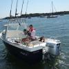
Tomo Posted November 5, 2006 Author Report Posted November 5, 2006 Well lads, I took all your advise on retun time and took my first trip out today...lots of mist this morning and buoys marking the channel, fished the ledge nothing but doggies......came back 3 hours before predicted low water....no buoys to be seen and OUCH!...new boat and now not so new prop..Stuck on the bar but I had 5 other boats for company.......Lesson learnt. Got some great pics of the sunset though. Tomo Quote
Coddy Posted November 6, 2006 Report Posted November 6, 2006 I know it's a stupid question .................. but why do they take the buoys up? Would seem that safety is paramount so leave them there. Coddy Quote
Wedger Posted November 6, 2006 Report Posted November 6, 2006 I heard a rumour that 'the bar' and sorta channel, change shape and move a bit during high outflow from the harbour. This would be greater during the winter months when the rivers are at full flow, coupled with the more unsettled stormy periods. Quote
Gazza Posted November 6, 2006 Report Posted November 6, 2006 A picture won't offer much protection, Gazza, you'll need the real thing. ...where's that blimin coat?? Asked for that one where you left it!!! Quote
Coddy Posted November 6, 2006 Report Posted November 6, 2006 I heard a rumour that 'the bar' and sorta channel, change shape and move a bit during high outflow from the harbour. This would be greater during the winter months when the rivers are at full flow, coupled with the more unsettled stormy periods. Hi Trev I can understand that, but when I use to fish up on the East coast from the river Deben, near Felixstowe, they were and still are moving the channel markers as the sand banks change. A survey is regularly carried out by the harbour master who advises Trinity House to move markers. This happens all year long! Perhaps the Christchurch Harbour Master only works in the Summer! Coddy Quote


Recommended Posts
Join the conversation
You can post now and register later. If you have an account, sign in now to post with your account.